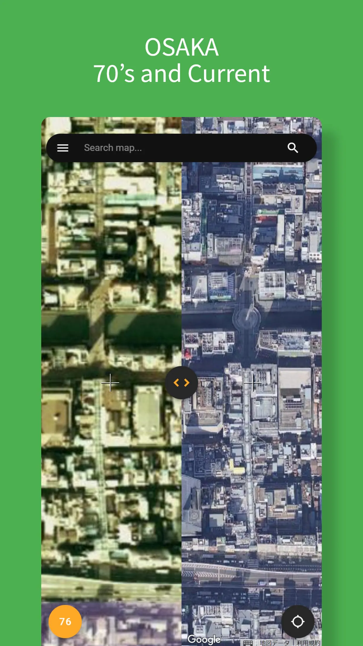
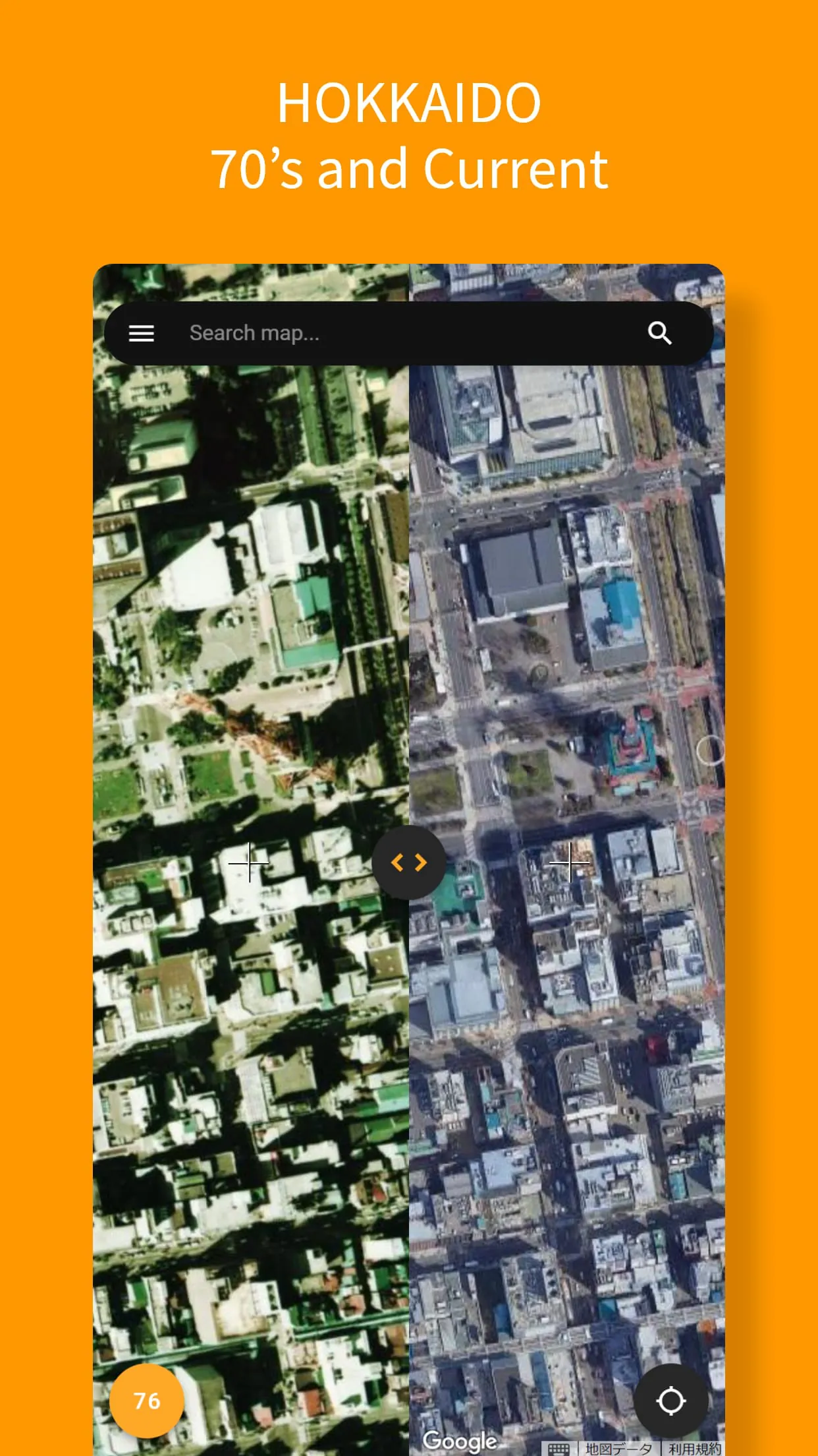
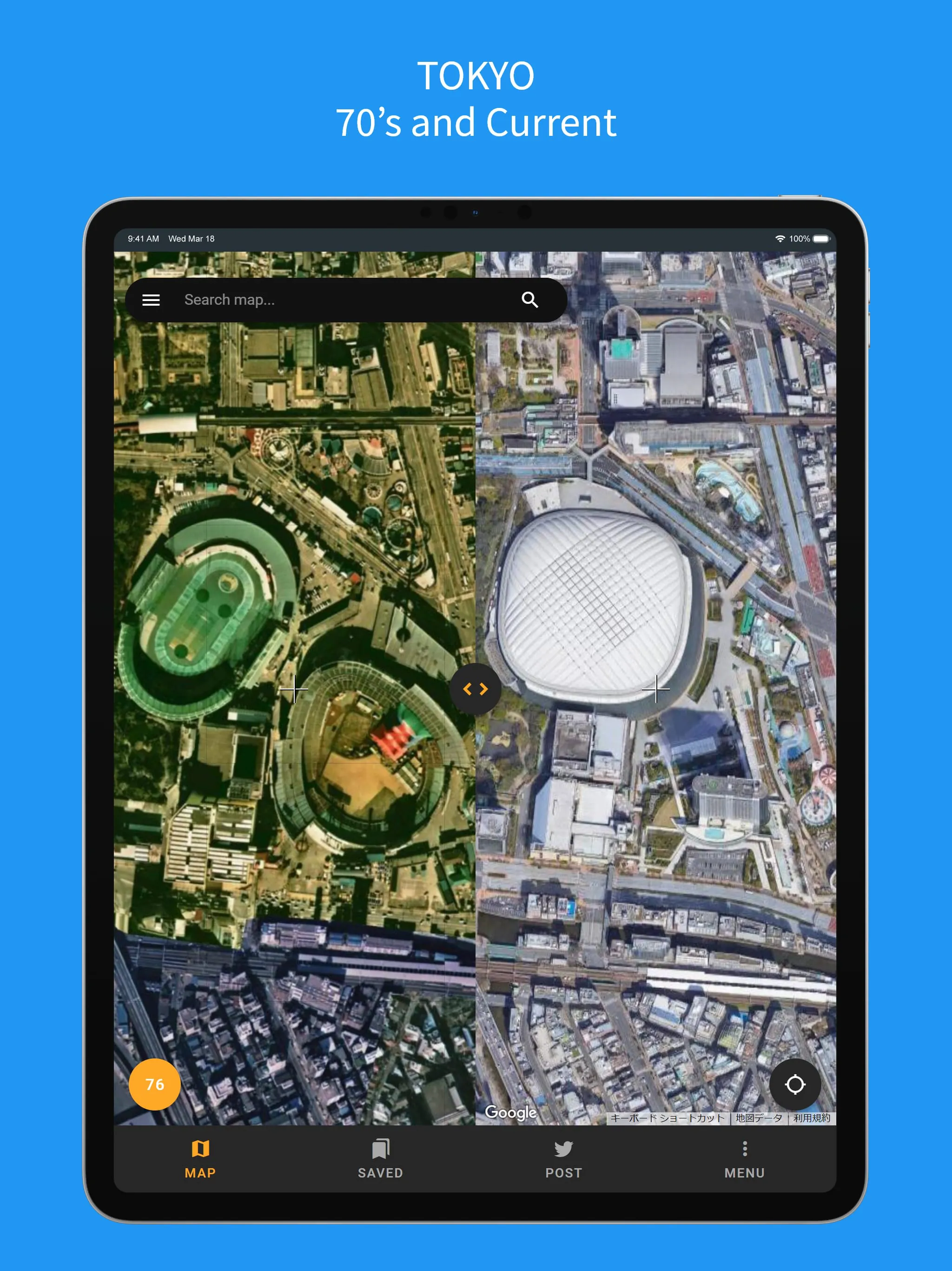
This application provides a unique and engaging way to explore historical aerial photography from the 1970s, allowing users to compare these images with contemporary views using Google Maps. The core functionality centers around a side-by-side display, where the modern Google Maps interface is juxtaposed with aerial photographs taken in the 1970s. This feature enables users to visually analyze the changes and developments that have occurred in specific locations over the past few decades. The application's ability to acquire and display the user's current location enhances its utility, allowing for immediate comparisons between the past and present landscapes of their surroundings. Furthermore, the full-screen mode allows users to navigate and explore the 1970s map in detail, providing a comprehensive and immersive experience. One of the application's strengths lies in its access to a rich historical dataset. It leverages aerial photographs published by the Geospatial Information Authority of Japan (GSI), ensuring the accuracy and reliability of the historical imagery. The availability of aerial photographs from multiple years, including 1945, 1936, 1976, 1981, 1985, and 1990, adds another layer of depth to the application. While the temporal coverage may be limited to specific regions, primarily urban areas, the ability to view aerial photographs from different eras provides valuable insights into urban evolution and historical land use patterns. By combining the familiarity of Google Maps with historical aerial imagery, this application offers a valuable tool for historians, researchers, urban planners, and anyone interested in exploring the past. The user-friendly interface and seamless integration of historical and modern maps make it accessible to a wide range of users, regardless of their technical expertise. The ability to compare aerial photographs from different time periods allows for the identification of changes in land use, infrastructure development, and environmental conditions. For example, users can observe the expansion of urban areas, the construction of new roads and buildings, and the impact of natural disasters or human activities on the landscape. The application's potential applications extend beyond simple historical curiosity. It can be used for educational purposes, allowing students to learn about local history and geography in an interactive and engaging way. It can also be used by researchers to study urban development patterns, track environmental changes, and assess the impact of policy decisions. Urban planners can use the application to gain a better understanding of how cities have evolved over time, informing future planning and development decisions. The application's accessibility and ease of use make it a valuable tool for a wide range of users, from casual observers to professional researchers.
The application distinguishes itself by providing a seamless and intuitive user experience, making it easy for users to access and interpret historical aerial imagery. The side-by-side display of Google Maps and 1970s aerial photographs is a key feature, allowing for direct visual comparison of the same location across different time periods. This feature eliminates the need to switch between different applications or websites, streamlining the process of historical exploration. The ability to obtain and display the user's current location further enhances the application's usability, allowing users to immediately compare the past and present landscapes of their surroundings. This feature is particularly useful for those interested in exploring the history of their local area or understanding the changes that have occurred in their neighborhood. The full-screen mode allows users to immerse themselves in the 1970s map, exploring the historical landscape in detail. This feature is particularly useful for those interested in exploring specific areas or conducting in-depth research. The availability of aerial photographs from multiple years, including 1945, 1936, 1976, 1981, 1985, and 1990, adds another layer of depth to the application. While the temporal coverage may be limited to specific regions, primarily urban areas, the ability to view aerial photographs from different eras provides valuable insights into urban evolution and historical land use patterns. The application's use of data published by the Geospatial Information Authority of Japan (GSI) ensures the accuracy and reliability of the historical imagery. This is particularly important for those using the application for research or educational purposes. The application's potential applications extend beyond simple historical curiosity. It can be used for educational purposes, allowing students to learn about local history and geography in an interactive and engaging way. It can also be used by researchers to study urban development patterns, track environmental changes, and assess the impact of policy decisions. Urban planners can use the application to gain a better understanding of how cities have evolved over time, informing future planning and development decisions. The application's accessibility and ease of use make it a valuable tool for a wide range of users, from casual observers to professional researchers. The combination of historical aerial imagery and modern mapping technology creates a unique and engaging experience, allowing users to explore the past in a new and informative way. The application's potential for educational, research, and urban planning purposes makes it a valuable tool for a wide range of users.
In summary, this map application offers a valuable and engaging way to explore historical aerial photography, providing users with a unique perspective on the past and present landscapes of specific locations. The application's core features include a side-by-side display of Google Maps and 1970s aerial photographs, the ability to obtain and display the user's current location, and a full-screen mode for immersive exploration of the historical map. The application leverages data published by the Geospatial Information Authority of Japan (GSI), ensuring the accuracy and reliability of the historical imagery. While the temporal coverage may be limited to specific regions, primarily urban areas, the availability of aerial photographs from multiple years provides valuable insights into urban evolution and historical land use patterns. The application's potential applications extend beyond simple historical curiosity. It can be used for educational purposes, allowing students to learn about local history and geography in an interactive and engaging way. It can also be used by researchers to study urban development patterns, track environmental changes, and assess the impact of policy decisions. Urban planners can use the application to gain a better understanding of how cities have evolved over time, informing future planning and development decisions. The application's accessibility and ease of use make it a valuable tool for a wide range of users, from casual observers to professional researchers. The side-by-side comparison feature allows users to easily identify changes and developments that have occurred in specific locations over time, fostering a deeper understanding of urban evolution and historical land use patterns. The application's ability to display aerial photographs from different eras adds another layer of depth to the user experience, providing valuable insights into the impact of historical events, policy decisions, and technological advancements on the landscape. The user-friendly interface and seamless integration of historical and modern maps make the application accessible to a wide range of users, regardless of their technical expertise. The application's potential to promote historical awareness, support research efforts, and inform urban planning decisions makes it a valuable tool for a wide range of individuals and organizations. The ability to compare aerial photographs from different time periods allows users to witness the transformation of urban areas, the expansion of infrastructure, and the impact of environmental changes, fostering a greater appreciation for the history and evolution of the landscape.


 0.00
0.00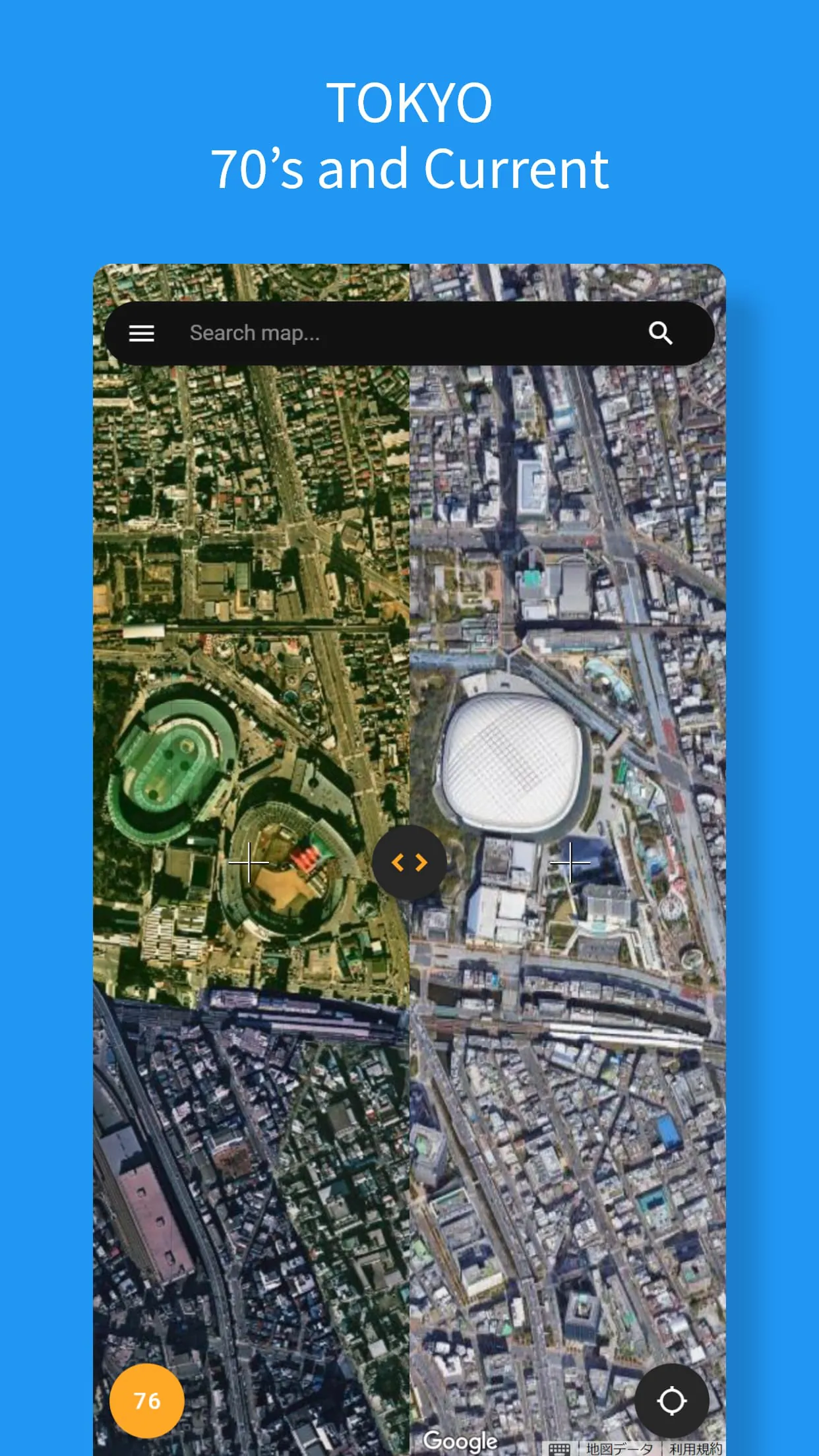
 Download


