


GPX Viewer GPX Viewer
Category
Travel & LocalVersion
V1.45.7
Tag
gps | viewer | gpx
Rate
4.40
★★★★★
Reviews
500 +
Installs
5M +
Developer
Vectura Games OÜ
Content Rating
Everyone
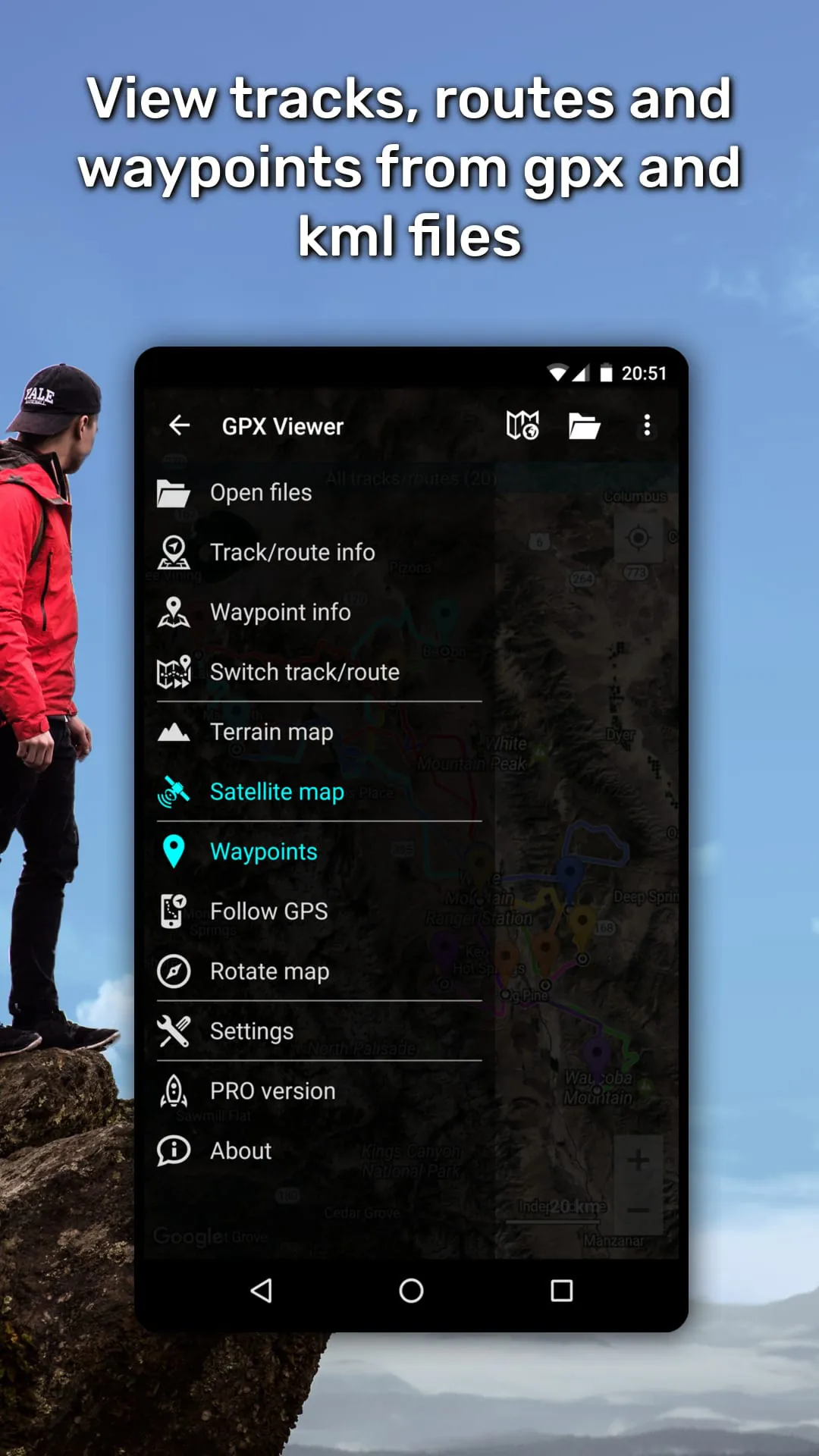
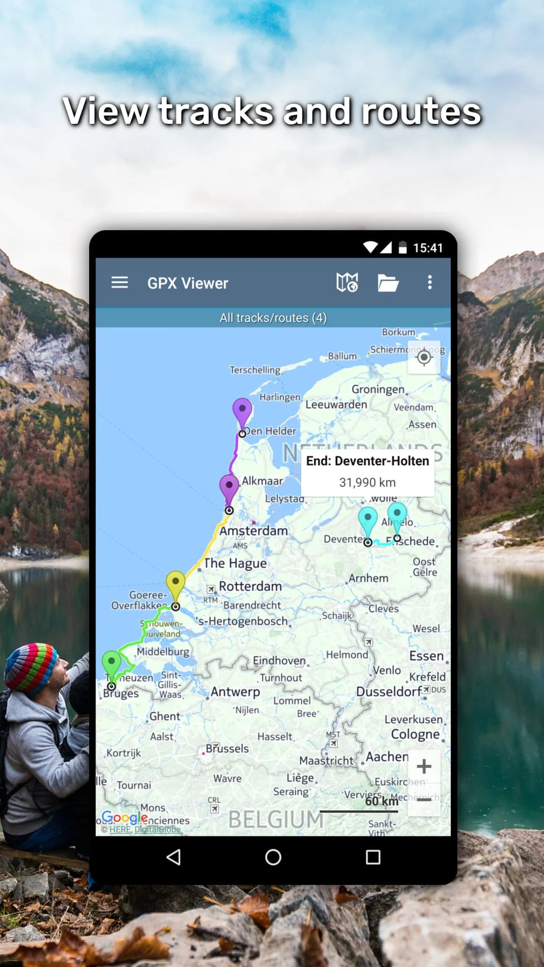
GPX Viewer shows tracks, routes and waypoints from gpx and kml files.
 4.40
4.40 Advertisements
Advertisements
Author's Review
appspicked Review
Advertisements
Advertisements
Screenshots


Additional Information
Category
Travel & LocalVersion
V1.45.7
Tag
gps | viewer | gpx
Rate
4.40
★★★★★
Reviews
500 +
Installs
5M +
Developer
Vectura Games OÜ
Content Rating
Everyone
GPX Viewer shows tracks, routes and waypoints from gpx and kml files.
Previous Versions
ZIP files require a Split APKs Installer (e.g., SAI) from Google Play to install. Steps: 1. Download SAI from Google Play; 2. Open SAI and tap "Install APKs"; 3. Select the ZIP file; 4. Complete installation.
V1.45.7

Package Name
com.vecturagames.android.app.gpxviewer
Version Name
V1.45.7
Version Code
V1.45.7
File Size
32.65 MB
Update time
2024-2-20
V1.45.4
Package Name
com.vecturagames.android.app.gpxviewer
Version Name
V1.45.4
Version Code
V1.45.4
File Size
32.81 MB
Update time
2024-1-19
V1.45.1
Package Name
com.vecturagames.android.app.gpxviewer
Version Name
V1.45.1
Version Code
V1.45.1
File Size
29.45 MB
Update time
2023-11-23
V1.44.3
Package Name
com.vecturagames.android.app.gpxviewer
Version Name
V1.44.3
Version Code
V1.44.3
File Size
28.56 MB
Update time
2023-10-12
V1.44.1
Package Name
com.vecturagames.android.app.gpxviewer
Version Name
V1.44.1
Version Code
V1.44.1
File Size
26.59 MB
Update time
2023-8-26
V1.44
Package Name
com.vecturagames.android.app.gpxviewer
Version Name
V1.44
Version Code
V1.44
File Size
26.54 MB
Update time
2023-8-12
V1.43.7
Package Name
com.vecturagames.android.app.gpxviewer
Version Name
V1.43.7
Version Code
V1.43.7
File Size
26.62 MB
Update time
2023-7-18
V1.43.6
Package Name
com.vecturagames.android.app.gpxviewer
Version Name
V1.43.6
Version Code
V1.43.6
File Size
26.36 MB
Update time
2023-7-4
V1.43.5
Package Name
com.vecturagames.android.app.gpxviewer
Version Name
V1.43.5
Version Code
V1.43.5
File Size
26.36 MB
Update time
2023-6-28
V1.43.4
Package Name
com.vecturagames.android.app.gpxviewer
Version Name
V1.43.4
Version Code
V1.43.4
File Size
25.14 MB
Update time
2023-5-25
V1.41.6
Package Name
com.vecturagames.android.app.gpxviewer
Version Name
V1.41.6
Version Code
V1.41.6
File Size
24.52 MB
Update time
2022-11-22
You Might Like


Advertisements