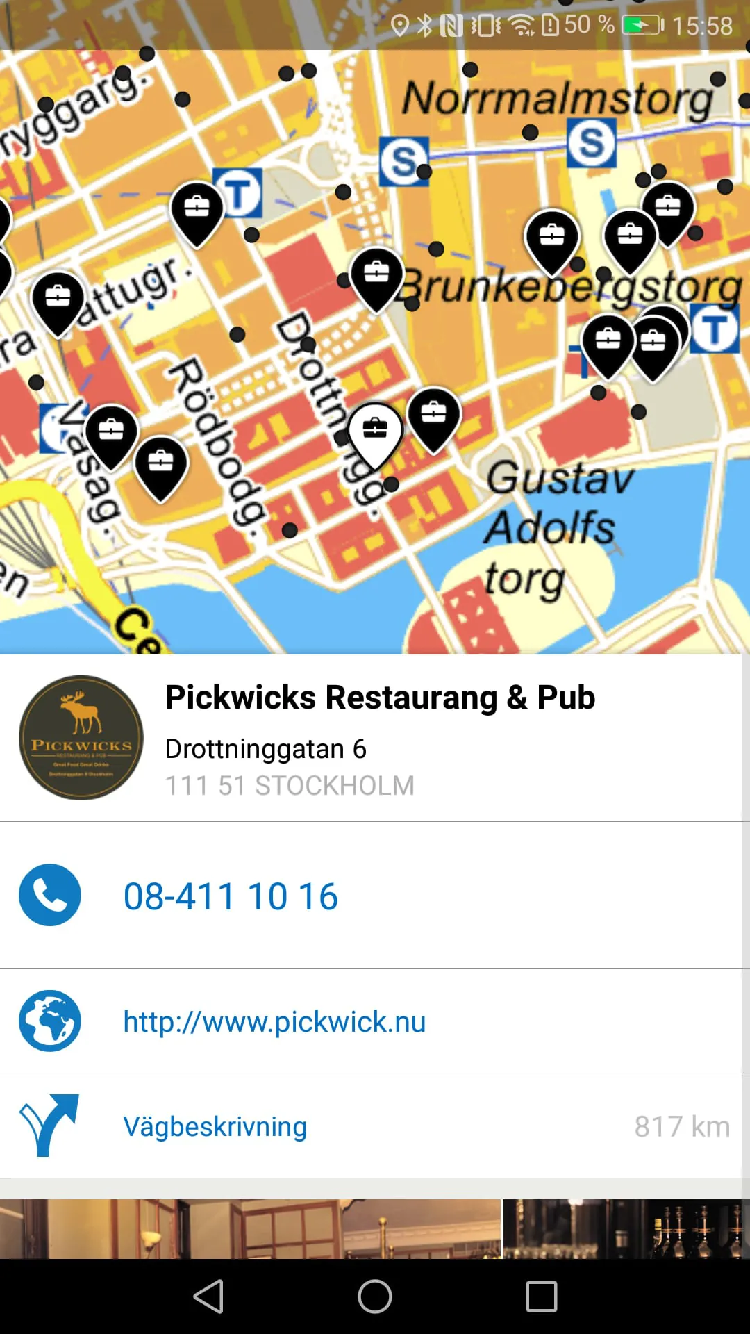
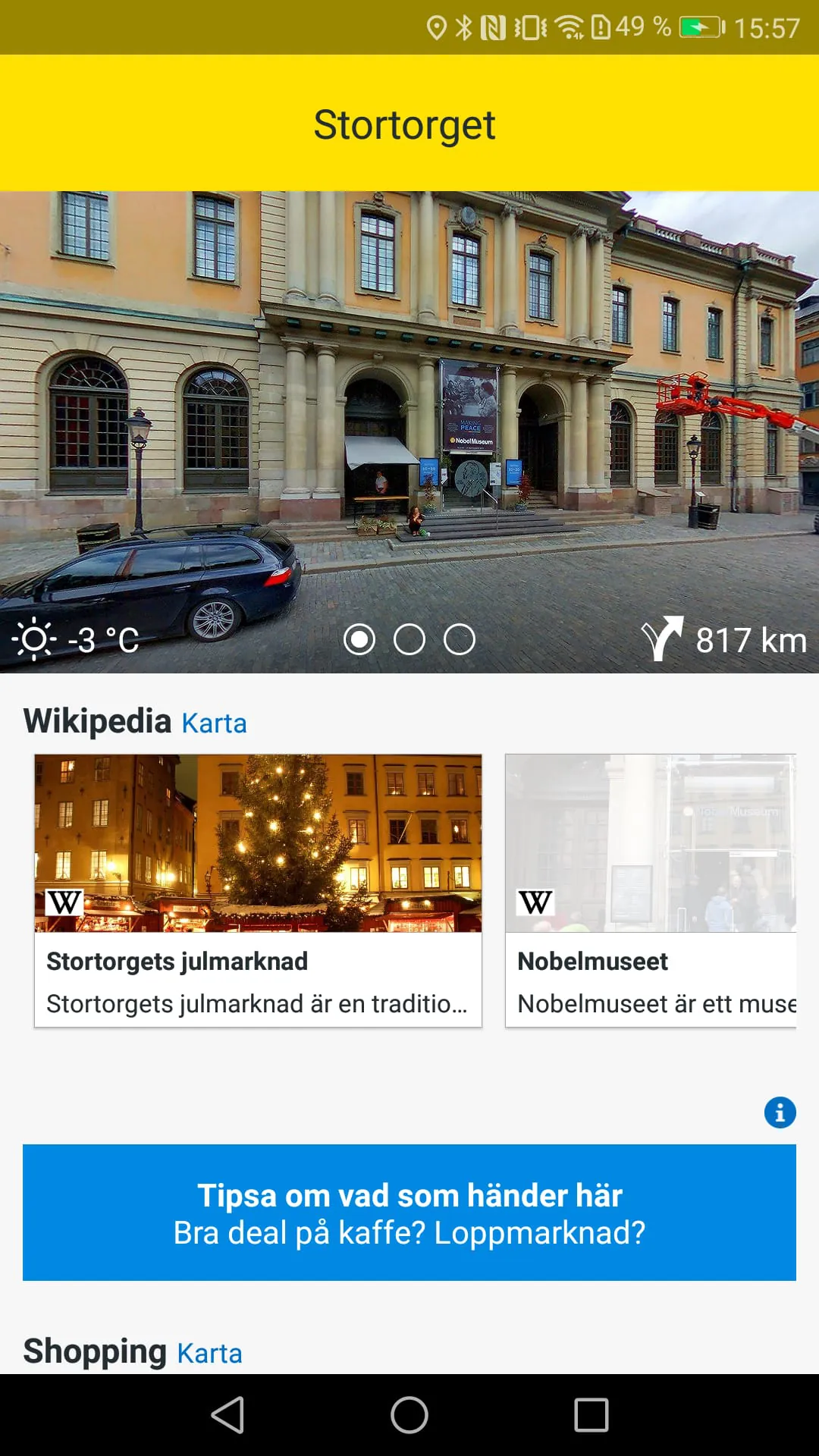
Eniro has transitioned from a basic company and contact search tool to a comprehensive application designed to enhance users' experiences within their local neighborhoods. The app's core functionality revolves around its 'Discover' feature, which offers an in-depth overview of the user's immediate surroundings. This feature aggregates information about new stores, highly-rated restaurants, historical landmarks, relevant Wikipedia entries, and other points of interest, presenting them in an accessible and visually appealing format. By leveraging the user's location on the Eniro map, the app identifies and highlights valuable establishments and attractions nearby. The updated Eniro app provides a range of features designed to improve local exploration and navigation. The 'Discover' function is a central element, showcasing local areas through detailed, image-focused presentations. This includes restaurants and informative Wikipedia posts, making it easy for users to find engaging places and information. Thousands of restaurant, bar, and hotel reviews from both Eniro and Yelp users are incorporated, giving users access to diverse opinions and recommendations to guide their choices. The updated restaurant search includes new inspirational filters, allowing users to refine their searches based on specific preferences and criteria. High-resolution maps are a crucial component of the app, offering various viewing options, such as aerial views, hybrid views that combine road names with aerial imagery, sea charts for maritime navigation, and street-level views for detailed urban exploration. The app helps users avoid traffic congestion by providing live traffic updates, allowing them to identify and steer clear of problem areas. Detailed road descriptions are available, enhancing navigation and making it easier for users to plan their routes. Bicycle enthusiasts can explore numerous bike routes throughout Sweden, promoting active transportation and outdoor recreation. With a fast and intuitive design, the map serves as the app's starting point, making it easy for users to immediately begin exploring their surroundings. Eniro's enhanced functionalities address a wide range of user needs, from finding local businesses and attractions to navigating efficiently and discovering new experiences. The integration of user reviews, detailed maps, and real-time traffic data positions Eniro as a comprehensive tool for both residents and visitors looking to make the most of their local environment. The app's focus on visual presentation and user-friendly design ensures that information is easily accessible and engaging, promoting a seamless and enjoyable exploration experience. By combining diverse data sources and intuitive features, Eniro has transformed from a simple search tool into a valuable resource for local discovery and navigation, providing users with the information and tools they need to fully engage with their surroundings.
The Eniro app's 'Discover' function is meticulously designed to provide users with an immersive and comprehensive understanding of their local environment. It aggregates a diverse array of information, ranging from newly opened stores to highly-rated restaurants and historically significant sites. By incorporating Wikipedia entries, the app also provides users with access to informative and educational content about their surroundings. The presentation of this information is visually driven, using images and detailed descriptions to capture the user's attention and provide a rich understanding of each location. This image-centric approach makes it easier for users to quickly assess the appeal of different establishments and attractions, allowing them to make informed decisions about where to visit. The app's ability to filter and prioritize information based on user preferences further enhances the 'Discover' function. Users can specify their interests, such as cuisine type, price range, or historical period, to narrow down the search results and focus on the establishments and attractions that are most relevant to them. This personalized approach ensures that users are not overwhelmed by irrelevant information and can quickly find the experiences that they are looking for. The 'Discover' function also leverages the user's location on the Eniro map to provide real-time recommendations and insights. By identifying the user's position, the app can suggest nearby restaurants, stores, and attractions that the user may not have been aware of. This feature is particularly valuable for visitors to a new area, as it allows them to quickly discover hidden gems and local favorites. The integration of user reviews from both Eniro and Yelp further enhances the 'Discover' function. These reviews provide users with valuable insights into the quality of different establishments, allowing them to make informed decisions based on the experiences of other users. The app also incorporates user ratings and rankings, which provide a quick and easy way to assess the popularity of different restaurants, bars, and hotels. By combining location-based recommendations, user reviews, and personalized filtering, the 'Discover' function transforms the Eniro app into a powerful tool for local exploration and discovery. Whether users are looking for a new restaurant to try, a historical landmark to visit, or a hidden gem to explore, the app provides them with the information and tools they need to make the most of their local environment. The visually appealing presentation and intuitive interface make the 'Discover' function easy to use and engaging, encouraging users to explore their surroundings and discover new experiences.
The Eniro app's enhanced features extend beyond the 'Discover' function, encompassing a range of tools designed to improve navigation, traffic management, and overall user experience. The inclusion of high-resolution maps, including aerial, hybrid, and sea chart views, provides users with a comprehensive understanding of their surroundings. Aerial views offer a bird's-eye perspective, allowing users to see the layout of streets, buildings, and natural features. Hybrid views combine road names with aerial imagery, providing a detailed and informative representation of the landscape. Sea charts are particularly useful for maritime navigation, providing information about water depths, navigational hazards, and other important maritime features. The availability of street view further enhances the mapping capabilities of the app, allowing users to virtually explore streets and neighborhoods. This feature is particularly valuable for planning routes, finding landmarks, and getting a sense of the local environment. The app's ability to provide live traffic updates is another valuable feature, helping users avoid traffic congestion and save time. By identifying problem areas in real-time, the app allows users to adjust their routes and find alternative paths. This feature is particularly useful during peak hours and in areas with heavy traffic. The integration of detailed road descriptions further enhances the app's navigation capabilities. These descriptions provide users with turn-by-turn directions, as well as information about road conditions, speed limits, and other important factors. The app also includes information about bicycle routes throughout Sweden, promoting active transportation and outdoor recreation. This feature is particularly useful for cyclists who are looking for safe and scenic routes to explore. The app's fast and intuitive design ensures that all of these features are easily accessible and user-friendly. The map serves as the app's starting point, allowing users to quickly begin exploring their surroundings. The app's interface is clean and uncluttered, making it easy to find the information and tools that users need. The app also includes a range of customization options, allowing users to tailor the app to their specific preferences. By combining detailed maps, live traffic updates, road descriptions, and bicycle route information, the Eniro app provides users with a comprehensive set of tools for navigation and exploration. The app's fast and intuitive design ensures that these features are easily accessible and user-friendly, making it a valuable resource for both residents and visitors.


 3.80
3.80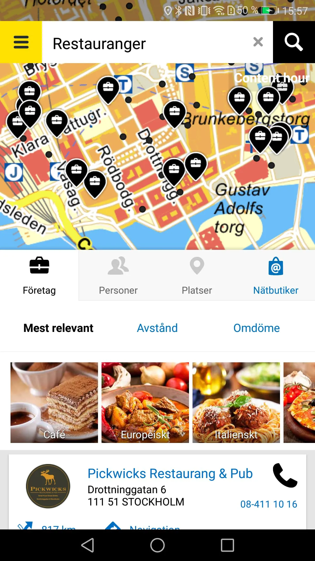
 Download


