


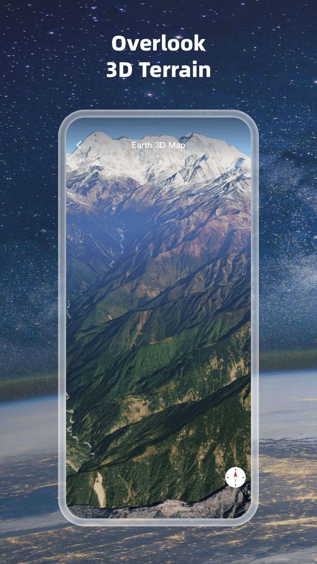
Earth 3D Map Earth 3D Map
Category
Maps & NavigationVersion
V2.3.1.1
Tag
map | satellite | satellites
Rate
4.30
★★★★★
Reviews
500 +
Installs
10M +
Developer
Foxpoi
Content Rating
Everyone
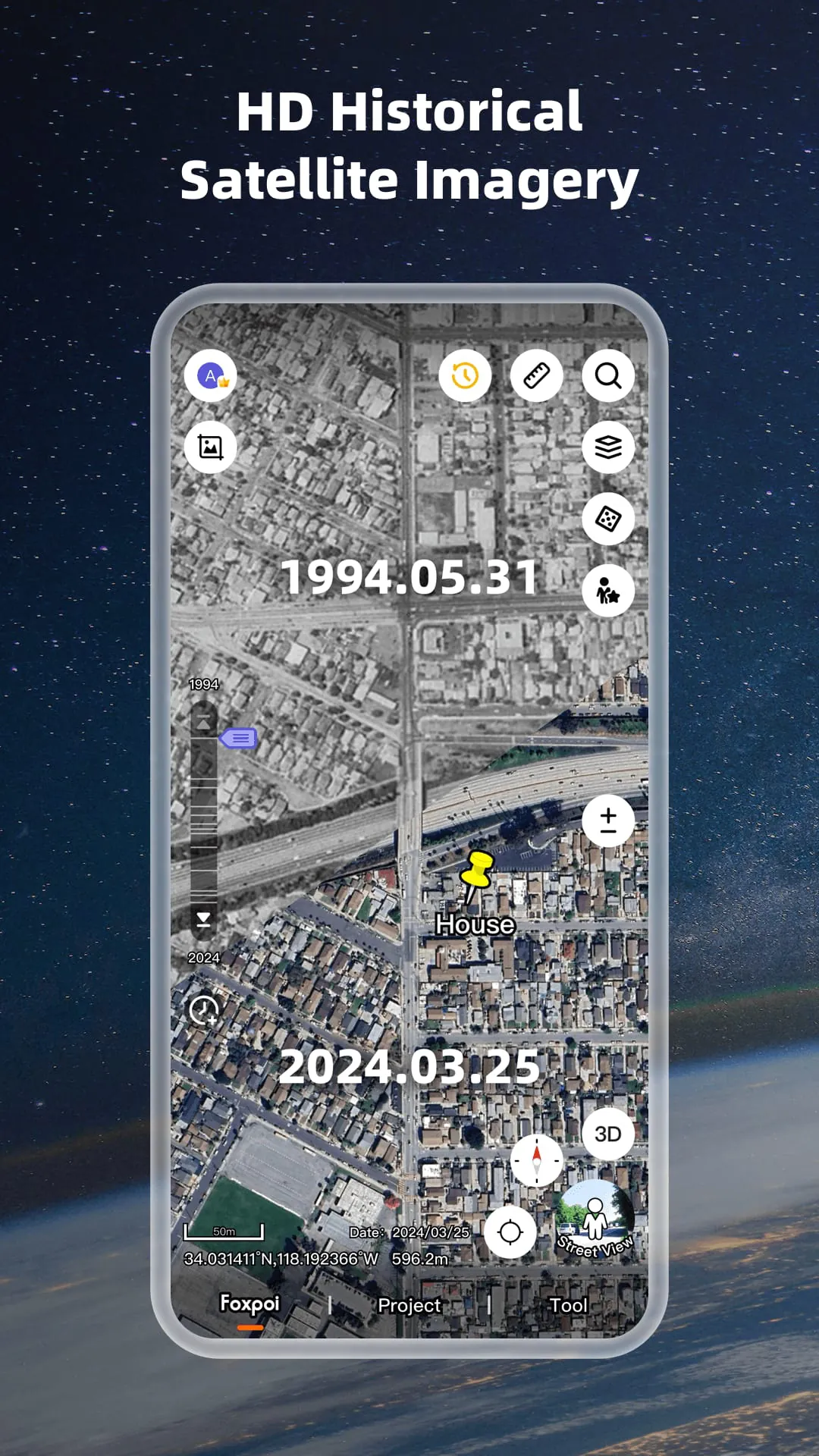
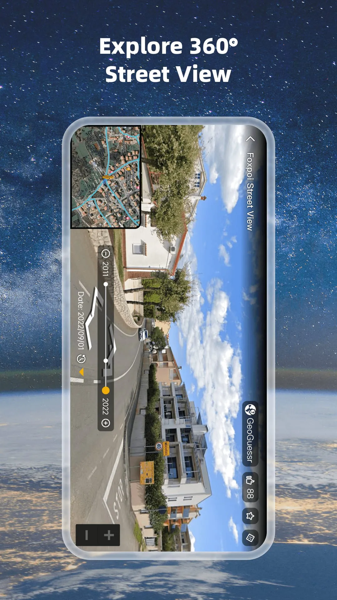
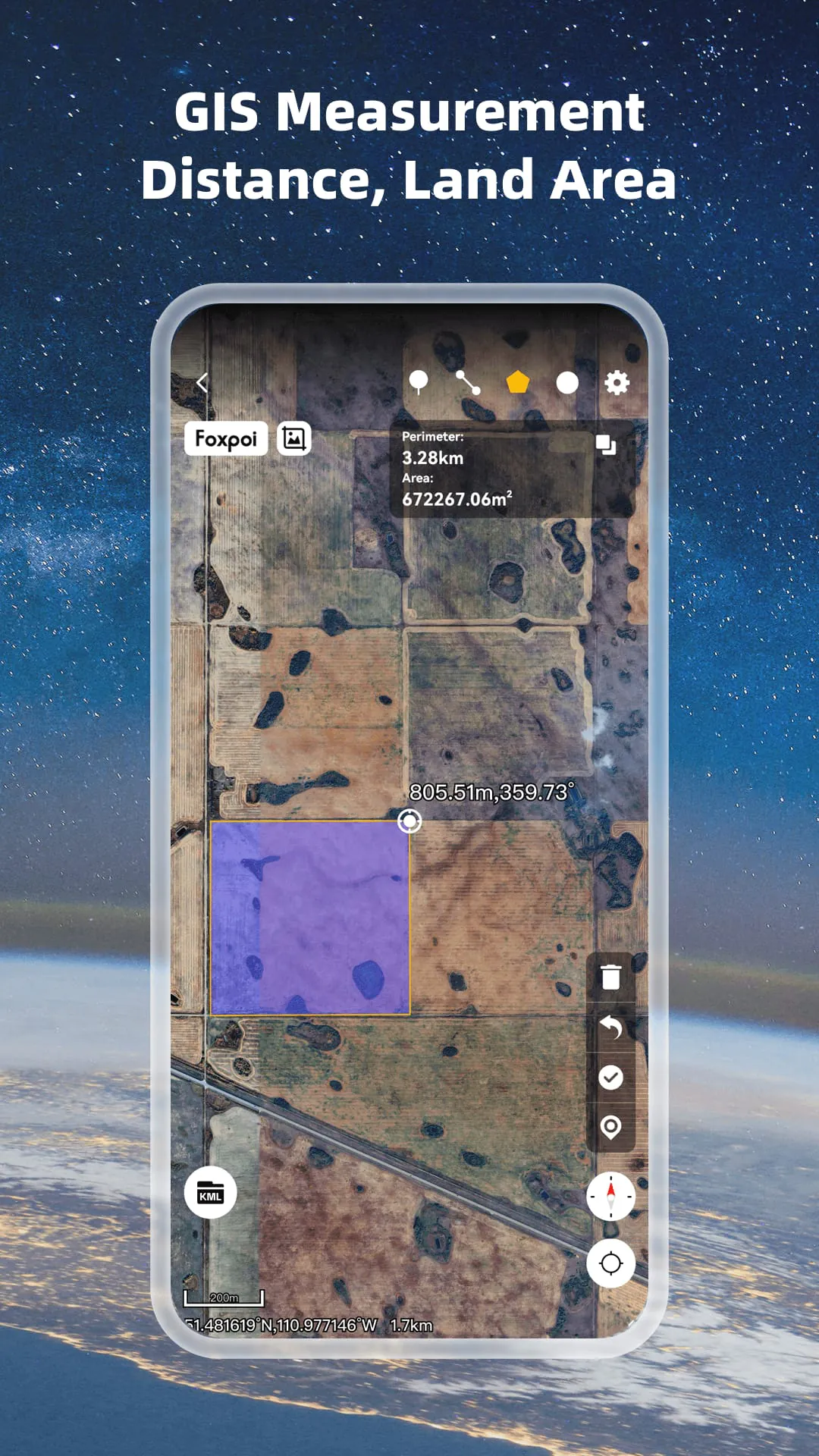
【2025】3D earth HD map,world street view,satellite imagery
 4.30
4.30 Advertisements
Advertisements
Author's Review
appspicked Review
Advertisements
Advertisements
Screenshots
Additional Information
Category
Maps & NavigationVersion
V2.3.1.1
Tag
map | satellite | satellites
Rate
4.30
★★★★★
Reviews
500 +
Installs
10M +
Developer
Foxpoi
Content Rating
Everyone
【2025】3D earth HD map,world street view,satellite imagery
Previous Versions
ZIP files require a Split APKs Installer (e.g., SAI) from Google Play to install. Steps: 1. Download SAI from Google Play; 2. Open SAI and tap "Install APKs"; 3. Select the ZIP file; 4. Complete installation.
V2.3.1.1

Package Name
com.think.earth
Version Name
V2.3.1.1
Version Code
V2.3.1.1
File Size
60.19 MB
Update time
2024-3-8
You Might Like


Advertisements