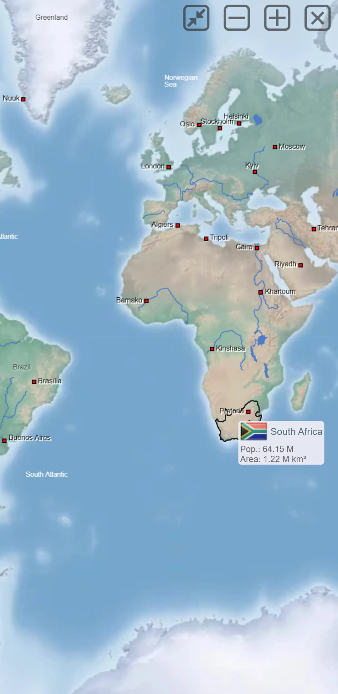
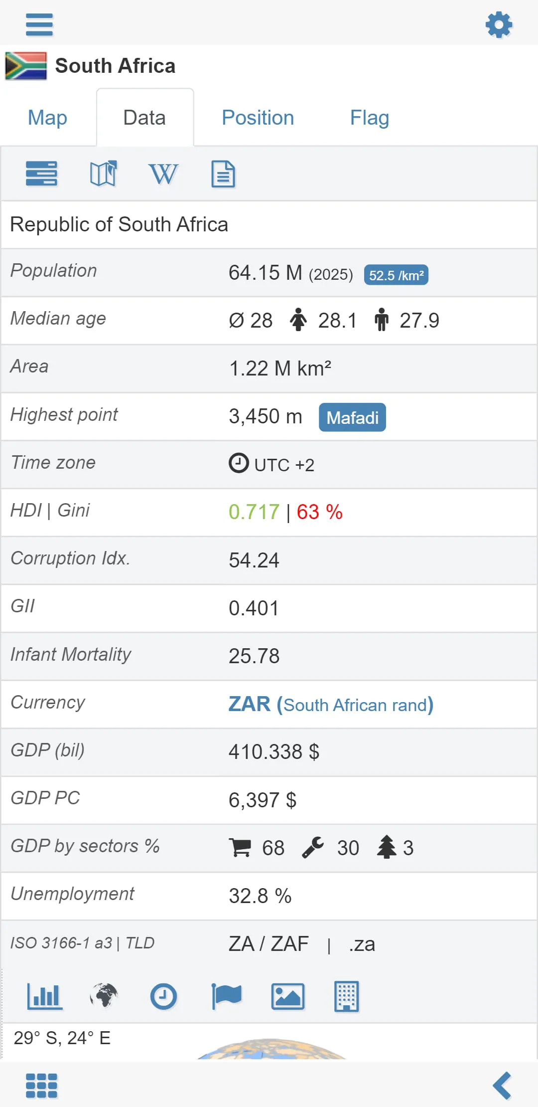
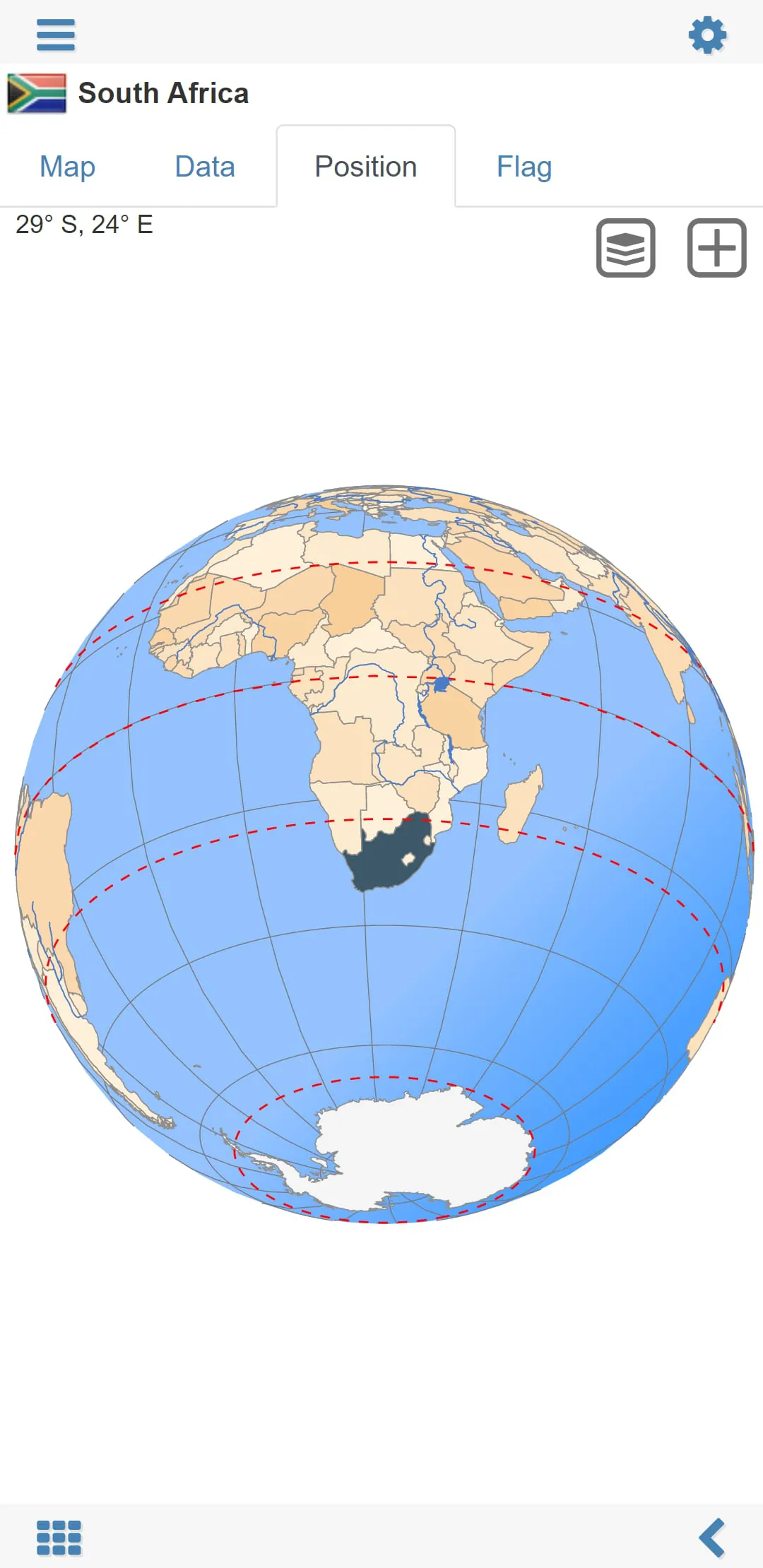
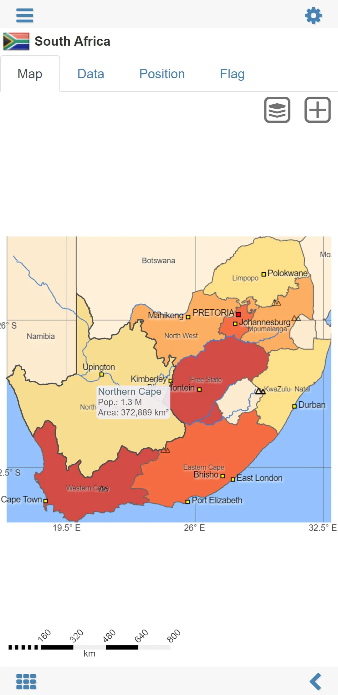
The "World atlas & world map MxGeo Free" is an educational app designed for smartphones and tablets that provides users with flags, position maps, and basic data for more than 260 countries and territories of the world. The app also includes interactive political world and continent maps, shaded relief layers for world and continent maps, and geography quiz challenges for playful learning. Users can search for countries, major cities, rivers, mountains, lakes, or coordinates, and compare countries, create favorites, and use the distance calculator. The app also includes comprehensive maps and data of all African countries, choropleth maps, and a world clock with time zone display.
The app offers six geo guessing games that test users' knowledge about the capitals of Africa, ISO countries codes, proper country flags based on the outline map, top-level domains of each country, highlighted country on the virtual globe, and mountains of Africa. The app is suitable for everyone, including children, adults, seniors, and teachers. It is a fun way to acquire geographic literacy and prepare for a stay abroad or geography lesson. The app is available in a free version that includes comprehensive data and maps for all African countries and a pro version that includes detailed data and maps for 260 countries and territories of the world.
The app has undergone several updates, including the addition of high-resolution flags for all countries, population growth charts for all countries, shaded relief layers for world and continent maps, an interactive rotating virtual globe, and additional regional position maps. Users can now display distances and areas in kilometers or miles, adjust font size for map labels, and view choropleth maps by area and population. The app does not require an online connection, making it accessible offline. Users can explore the world virtually and learn about different countries and territories.
In conclusion, the "World atlas & world map MxGeo Free" is an educational app that provides users with flags, position maps, and basic data for more than 260 countries and territories of the world. The app includes interactive political world and continent maps, geography quiz challenges, and comprehensive maps and data of all African countries. The app is suitable for everyone and offers six geo guessing games that test users' knowledge about different aspects of geography. The app has undergone several updates, including the addition of high-resolution flags, population growth charts, shaded relief layers, and additional regional position maps. The app is accessible offline and allows users to explore the world virtually.


 4.20
4.20