


TKGM Parsel Sorgu TKGM Parsel Sorgu
Category
CommunicationVersion
V2.4.24
Tag
maps | geographical | spatial
Rate
3.80
★★★★★
Reviews
500 +
Installs
5M +
Developer
Tapu ve Kadastro Genel Müdürlüğü
Content Rating
Everyone
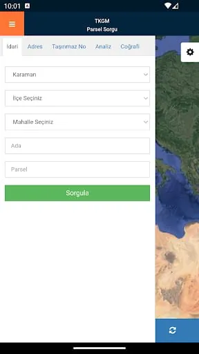
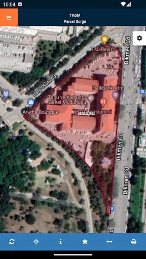
Query and display applications based on various criteria parcel in Turkey ...
 3.80
3.80 Advertisements
Advertisements
Author's Review
appspicked Review
Advertisements
Advertisements
Screenshots
Additional Information
Category
CommunicationVersion
V2.4.24
Tag
maps | geographical | spatial
Rate
3.80
★★★★★
Reviews
500 +
Installs
5M +
Developer
Tapu ve Kadastro Genel Müdürlüğü
Content Rating
Everyone
Query and display applications based on various criteria parcel in Turkey ...
Previous Versions
ZIP files require a Split APKs Installer (e.g., SAI) from Google Play to install. Steps: 1. Download SAI from Google Play; 2. Open SAI and tap "Install APKs"; 3. Select the ZIP file; 4. Complete installation.
V2.4.24

Package Name
com.tkgm.parselsorgu
Version Name
V2.4.24
Version Code
V2.4.24
File Size
7.92 MB
Update time
2023-8-9
You Might Like


Advertisements