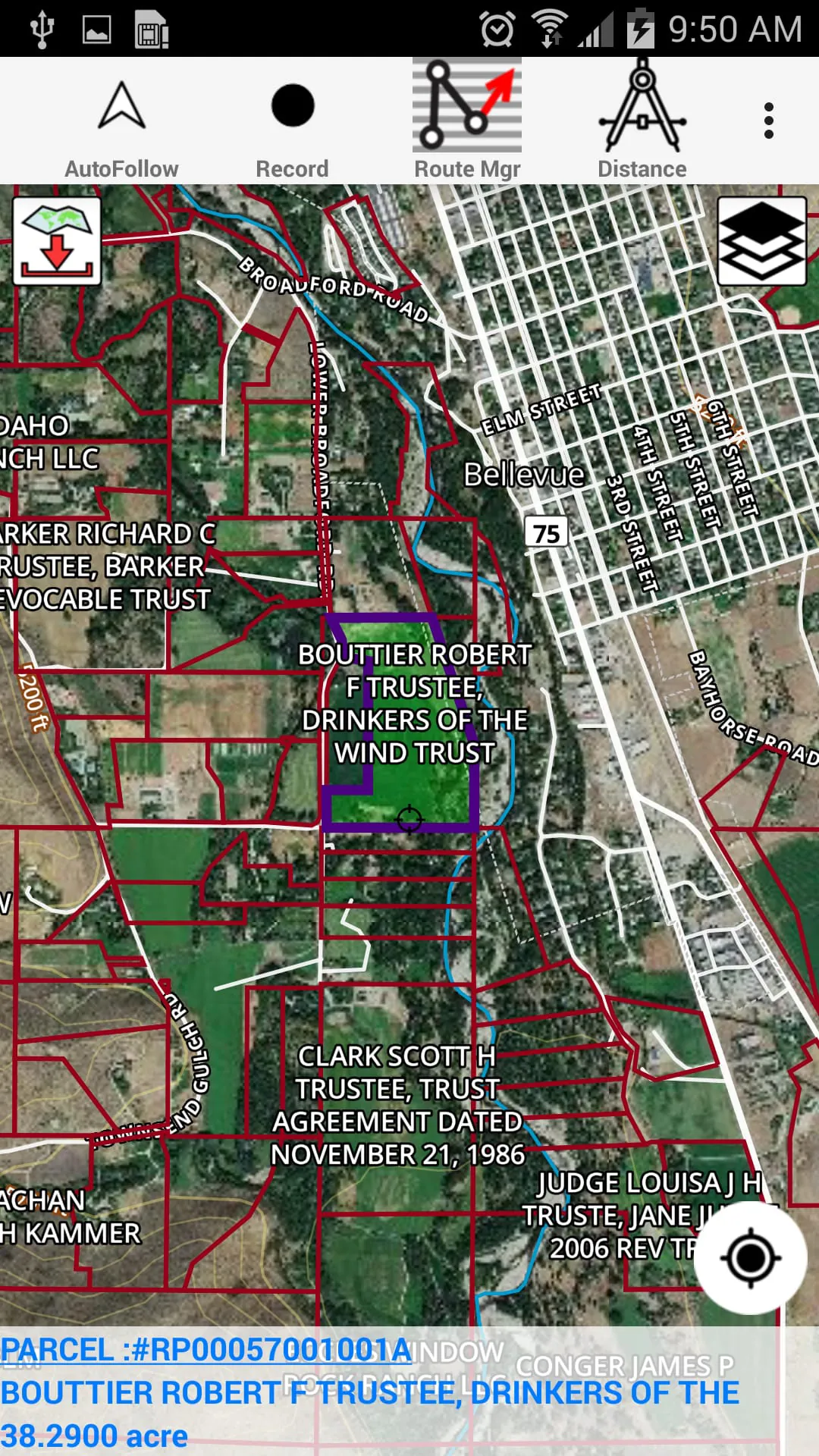
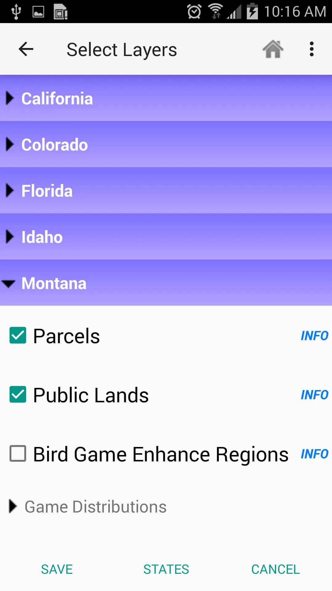
The i-Hunting GPS app is a comprehensive tool for outdoor enthusiasts, providing access to property line maps, land ownership details, and map layers for 50+ states. The app features vector topo maps with the most accurate USGS elevation contours, hiking and biking trails, and coverage for all US states. The vector topo maps are hardware/GPU accelerated and include beautiful and detailed graphics, with text that stays upright on rotation. The app also includes PLSS maps with US-wide coverage and custom base maps that can be switched between vector topos, hybrid satellite imagery, and more.
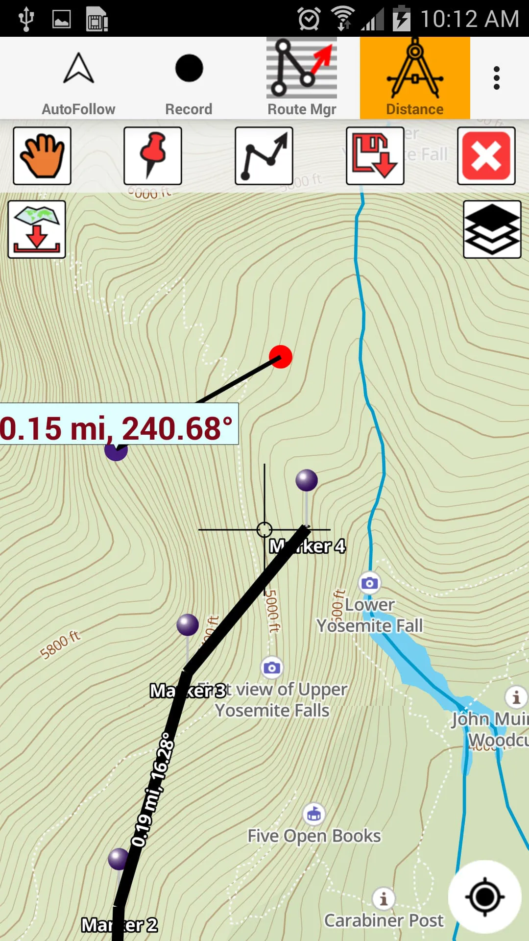
The app's GPS features include the ability to record tracks, enter or import waypoints, and auto-follow. The app also includes real-time track overlay, predicted path vector, course up (text stays upright), speed and heading, and route assistance with voice prompts. The app's route management and trip planning features allow users to create new routes, edit existing routes, move points, add points to an existing route leg, delete or rename points, import GPX, KML, and KMZ files, plot/edit routes, enter waypoints, share/export routes, tracks, and markers, and reverse routes.
The i-Hunting app is ideal for a variety of outdoor activities, including hunt planning and recon, off-trail and on-trail hiking, backpacking with topos of national forests and wilderness areas with GPS, snow sports (snowshoeing, skiing, snowboarding, snowmobiling), and search and rescue (SAR). The app can turn your phone into a full-fledged outdoor GPS unit, complementing the gear you already have from Dick's, REI, Cabelas, and other outdoor retailers.
The app also includes detailed topographic trail maps for national and state parks, including Great Smoky Mountains, Grand Canyon, Zion, Rocky Mountain, Yosemite, Yellowstone, Acadia, Olympic, Denali, and Glacier. The app allows users to share tracks, routes, and markers on Facebook and Twitter, and export tracks, routes, and markers as compressed GPX files. The i-Hunting app is a must-have for any outdoor enthusiast looking for a comprehensive GPS tool for their adventures.
Overall, the i-Hunting GPS app is a comprehensive tool for outdoor enthusiasts, providing access to property line maps, land ownership details, and map layers for 50+ states. The app's GPS features include the ability to record tracks, enter or import waypoints, and auto-follow, with real-time track overlay, predicted path vector, course up (text stays upright), speed and heading, and route assistance with voice prompts. The app's route management and trip planning features allow users to create new routes, edit existing routes, move points, add points to an existing route leg, delete or rename points, import GPX, KML, and KMZ files, plot/edit routes, enter waypoints, share/export routes, tracks, and markers, and reverse routes. The app is ideal for a variety of outdoor activities, including hunt planning and recon, off-trail and on-trail hiking, backpacking with topos of national forests and wilderness areas with GPS, snow sports (snowshoeing, skiing, snowboarding, snowmobiling), and search and rescue (SAR). The app also includes detailed topographic trail maps for national and state parks, including Great Smoky Mountains, Grand Canyon, Zion, Rocky Mountain, Yosemite, Yellowstone, Acadia, Olympic, Denali, and Glacier.


 3.50
3.50