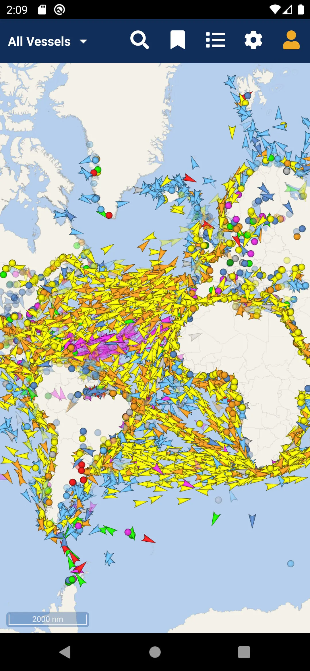
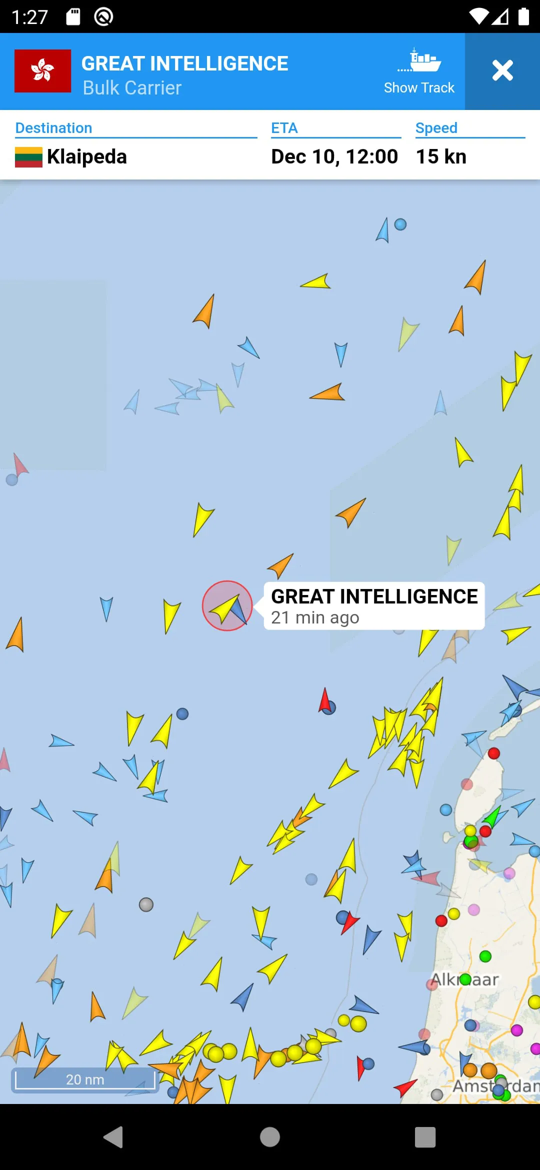
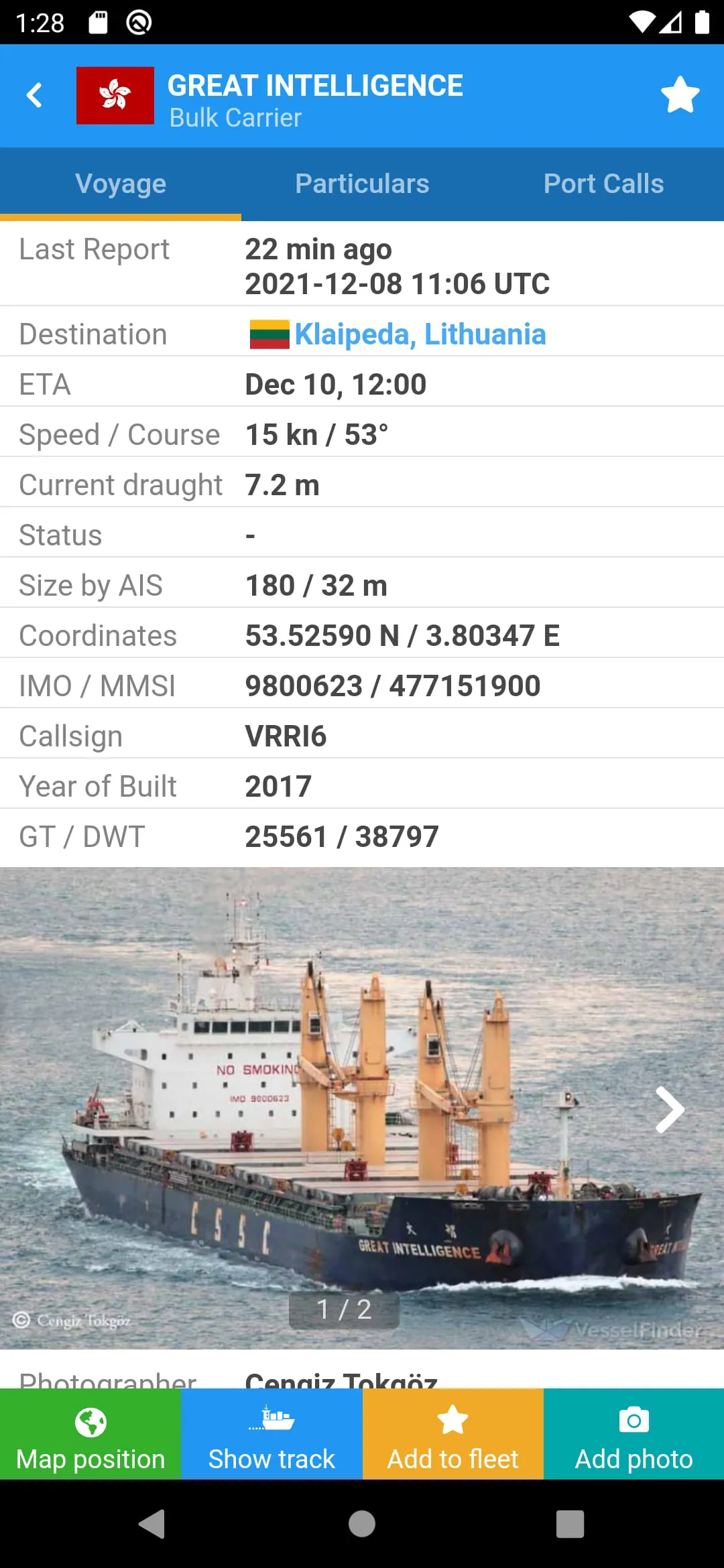
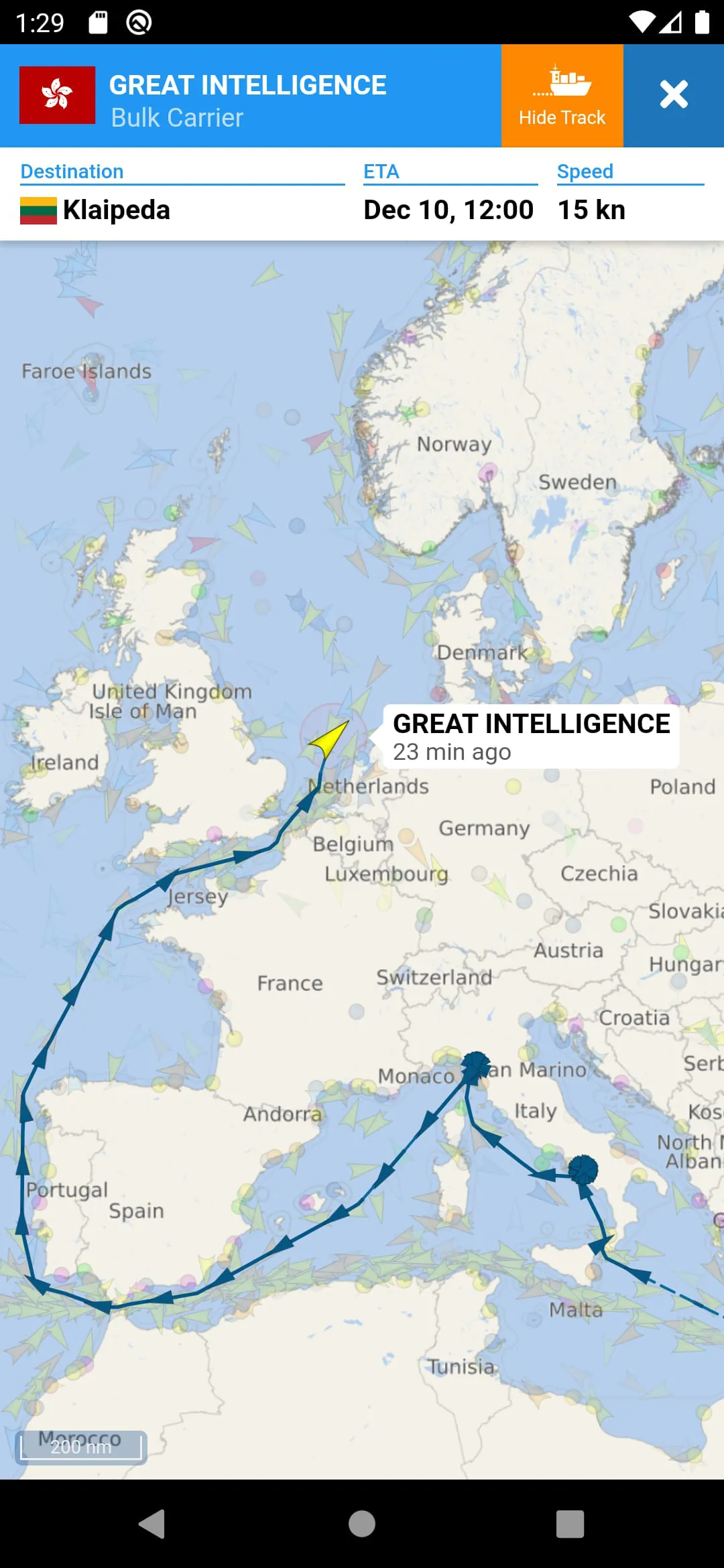
VesselFinder is a vessel tracking app that provides real-time data on the positions and movements of over 200,000 ships every day. The app uses a large network of satellites and terrestrial AIS receivers to track ships, and features include real-time tracking of ships, ship search by name, IMO number or MMSI number, ship movements history, and ship details such as name, flag, type, IMO, MMSI, destination, ETA, draught, course, speed, gross tonnage, year of built, size and more.
In addition to ship tracking, VesselFinder also allows users to search for ports by name or LOCODE, and provides information on port calls per ship with time of arrival and stay in ports, and port calls per port with a detailed list of all vessels expected, arrivals, departures and currently in port. Users can add their favourite vessels to "My Fleet," synchronised with their VesselFinder account, and save their favourite map views for quick navigation with the "My Views" feature.
The app also includes ship photos contributed by VesselFinder users, simple, detailed, dark and satellite maps, weather layers (temperature, wind, waves), a "See Your Location" feature, and a distance measure tool. However, users are advised to fill out a form on the VesselFinder website instead of writing a review if they experience any problems with the app. The visibility of vessels in the app depends on AIS signal availability, and completeness and accuracy of the information provided cannot be guaranteed.
VesselFinder is a comprehensive vessel tracking app that provides real-time data on the positions and movements of ships. The app uses a large network of satellites and terrestrial AIS receivers to track over 200,000 ships every day, and features include real-time tracking of ships, ship search by name, IMO number or MMSI number, ship movements history, and ship details such as name, flag, type, IMO, MMSI, destination, ETA, draught, course, speed, gross tonnage, year of built, size and more.
In addition to ship tracking, VesselFinder also allows users to search for ports by name or LOCODE, and provides information on port calls per ship with time of arrival and stay in ports, and port calls per port with a detailed list of all vessels expected, arrivals, departures and currently in port. Users can add their favourite vessels to "My Fleet," synchronised with their VesselFinder account, and save their favourite map views for quick navigation with the "My Views" feature.
The app also includes ship photos contributed by VesselFinder users, simple, detailed, dark and satellite maps, weather layers (temperature, wind, waves), a "See Your Location" feature, and a distance measure tool. However, users are advised to fill out a form on the VesselFinder website instead of writing a review if they experience any problems with the app. The visibility of vessels in the app depends on AIS signal availability, and completeness and accuracy of the information provided cannot be guaranteed.
VesselFinder is a vessel tracking app that provides real-time data on the positions and movements of ships. The app uses a large network of satellites and terrestrial AIS receivers to track over 200,000 ships every day, and features include real-time tracking of ships, ship search by name, IMO number or MMSI number, ship movements history, and ship details such as name, flag, type, IMO, MMSI, destination, ETA, draught, course, speed, gross tonnage, year of built, size and more.
In addition to ship tracking, VesselFinder also allows users to search for ports by name or LOCODE, and provides information on port calls per ship with time of arrival and stay in ports, and port calls per port with a detailed list of all vessels expected, arrivals, departures and currently in port. Users can add their favourite vessels to "My Fleet," synchronised with their VesselFinder account, and save their favourite map views for quick navigation with the "My Views" feature.
The app also includes ship photos contributed by VesselFinder users, simple, detailed, dark and satellite maps, weather layers (temperature, wind, waves), a "See Your Location" feature, and a distance measure tool. However, users are advised to fill out a form on the VesselFinder website instead of writing a review if they experience any problems with the app. The visibility of vessels in the app depends on AIS signal availability, and completeness and accuracy of the information provided cannot be guaranteed.


 3.90
3.90