


GPS Tools® GPS Tools®
Category
ToolsTag
gps | hiking | Tools
Rate
4.50
★★★★★
Reviews
500 +
Installs
10M +
Developer
VirtualMaze
Content Rating
Everyone
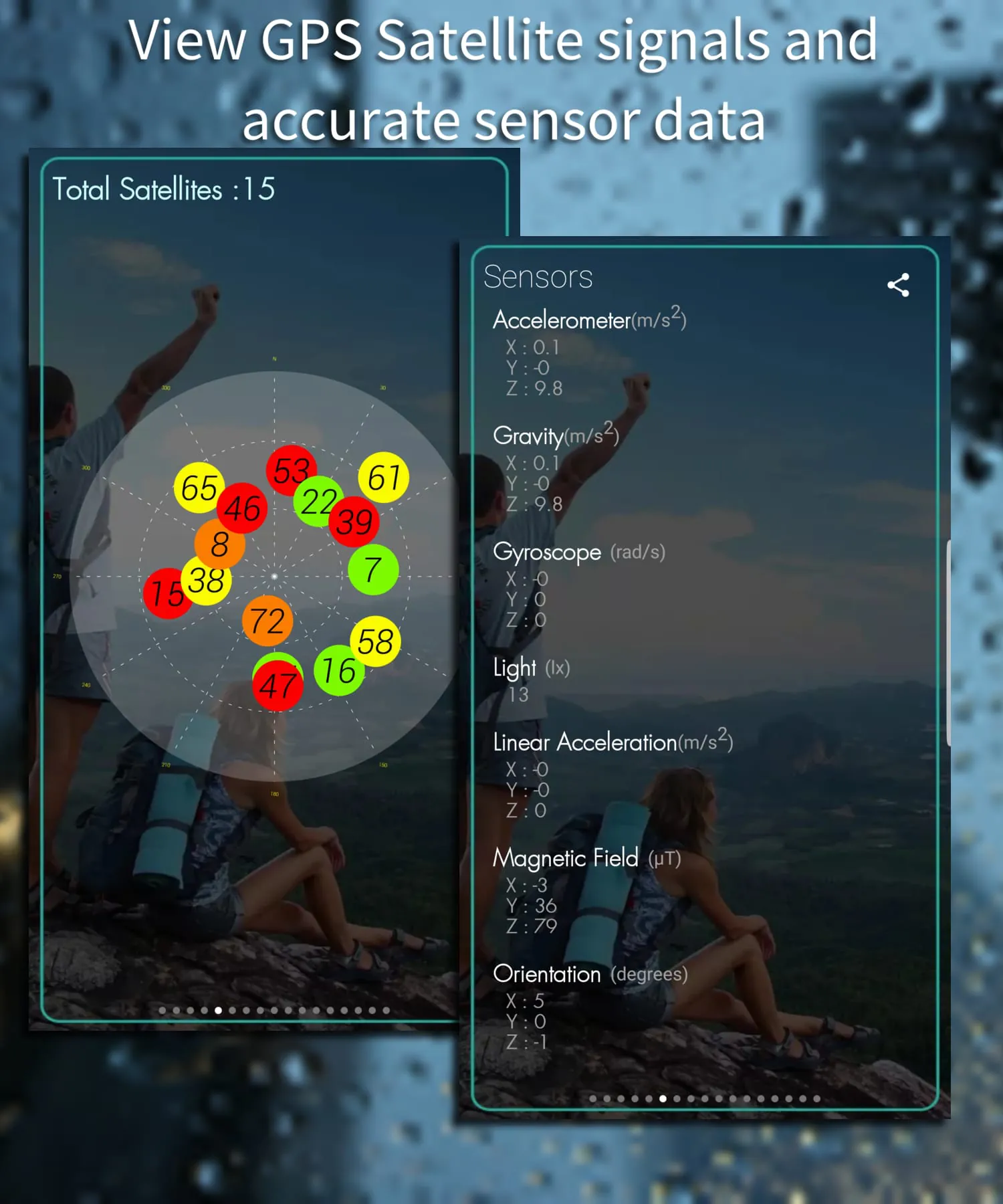
GPS Tools helps you in outdoor activities, travel, trekking, measurements, etc,.
 4.50
4.50 Advertisements
Advertisements
Author's Review
appspicked Review
Advertisements
Advertisements
Screenshots
 Download
 Additional Information
Category
ToolsVersion
Unknown
Tag
gps | hiking | Tools
Rate
4.50
★★★★★
Reviews
500 +
Installs
10M +
Developer
VirtualMaze
Content Rating
Everyone
GPS Tools helps you in outdoor activities, travel, trekking, measurements, etc,.
Previous Versions
ZIP files require a Split APKs Installer (e.g., SAI) from Google Play to install. Steps: 1. Download SAI from Google Play; 2. Open SAI and tap "Install APKs"; 3. Select the ZIP file; 4. Complete installation.
You Might Like


Advertisements